Thursday, November 11, 15.00 - 17.00 h(Van Nelle Ontwerpfabriek, Open Brunch space)
Friday, November 12 and Saturday, November 13, 10.00h - 17.00hLocation (meeting points):
During the workshop's introduction of Thursday (November 11, 15.00h), participants can register for these all or some of these workshop segments. Workshop Segments: BIOMAPPING (segment A)by Christian Nold (D/GB)Location (meeting point): V2_ Institute for the Unstable Media, Eendrachtsstraat 10, Rotterdam Bio Mapping explores new ways that we as individuals can make use of the information we can gather about our own bodies. Instead of security technologies that are designed to control our behaviour, this project envisages new tools that allows people to selectively share and interpret their own bio data. The current version of the Bio Mapping system allows people to measure their Galvanic Skin Response (GSR), which is a simple indicator of emotional arousal in conjunction with their geographical location. By sharing this information we can construct maps that visualise where we as a community feel stressed and excited. Will other people's experiences allow us to engage differently with our environment? Go on tours wearing the Bio Mapping set to explore the connection between city's places and your emotional arousals. www.softhook.com, www.biomapping.net FRIDA V. (Free Ride Data Aquisition Vehicle) (segment B)by Luka Frelih (SI)Meeting points:
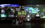
Marine Radar and Sensor Array Tracking Device (segment C)installed, manned and presented by Ewen Chardronnet (F) and Aljosa Abrahamsberg (SI)Location: Tea Room on roof of main Van Nelle building The Marine Radar and Sensor Array Tracking Device will be installed at DEAF to measure and gage the unseen flow and interaction of marine traffic and electro-communications activity within the unique port influenced urban environment of the city of Rotterdam, the Marine Radar and Sensor Array Tracking Device conceived by Projekt Atol - Pact Systems (SI) for mapping the electromagnetic spectrum will be activated during the workshop period. The workshop introduces to the history of radar technology, which sill is not fully investigated for its environmental applications, and explores the role of the Control Towers of the coasts and ports that use this type of technologies. This condition almost suggests by itself to investigate further the potentiality of the technology and its equipment: for example to use it for environmental monitoring and psychoartistic works. One concrete aim of the workshop is to work on the radar's display output signal, so it can be reused to display on big screens and to establish a stream, what would open the options of use significant and allow you to link together several radar systems. Experts call: Although the workshop is open to the general public we are seeking the inclusion of media artists, programmers, stream specialists and radar/radio amateurs to participate in this challenge. Please bring your laptop and, if possible, stream kit with you. A presentation on the history of radar, CMR (Civil Marine Radar) applications and radio scanners for tactical and artistic purposes will take place subsequent to the general introduction on Thursday, November 11. Het in kaart brengen van een gebied is altijd een exclusieve, gesloten bezigheid geweest, een middel om de hiërarchie van overheden en bureaucratieën te legitimeren en te handhaven. Deze driedaagse workshop in Rotterdam betrekt het publiek bij kunstzinnige en actiegerichte projecten van webcartografie als deelnemers in het creëren van open stedelijke cartografische systemen.
projects:
participants:
Christian Nold (GB), Luka Frelih (SI), Aljosa Abrahamsberg (SI), Ewen Chardronnet (FR), Marc Tuters (CA), Karlis Kalnins (LV)
|
 |